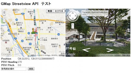
[GMaps API v3] ストリートビューを使う。
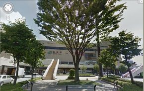
ストリートビュー、27市町村も対象に グーグル 群馬
グーグル グッジョブ! ( ̄∇ ̄ノノ”パチパチパチ!!
これまでは「ストビューなんて使えるのは、所詮一部の都会人だけ」と手を出さずに拗ねていましたが、これから心を入れ替えて勉強しようと思います。
とりあえず基本から。
|
1 2 3 4 5 6 7 8 9 10 11 12 13 14 15 16 17 18 19 20 21 22 23 24 25 26 27 28 29 30 31 32 |
<!DOCTYPE HTML> <html> <head> <title>GMap Streetview example</title> <script src="http://maps.googleapis.com/maps/api/js?sensor=false"></script> <script src="index.js"></script> </head> <body onload="initialize()"> <h2>GMap Streetview API テスト </h2> <div> <div id="map_canvas" style="float:left;width: 400px; height: 300px"></div> <div id="pano" style="width: 400px; height: 300px;"></div> </div> <div id="panoInfo" style="width: 425px; height: 240 px;"> <table> <tr> <td><b>Position</b></td><td id="position_cell"> </td> </tr> <tr> <td><b>POV Heading</b></td><td id="heading_cell">270</td> </tr> <tr> <td><b>POV Pitch</b></td><td id="pitch_cell">0.0</td> </tr> </table> </div> <input id="address" type="textbox" value="群馬県前橋市"> <input type="button" value="検索" onclick="addressSearch()"> </body> </html> |
|
1 2 3 4 5 6 7 8 9 10 11 12 13 14 15 16 17 18 19 20 21 22 23 24 25 26 27 28 29 30 31 32 33 34 35 36 37 38 39 40 41 42 43 44 45 46 47 48 49 50 51 52 53 54 55 56 57 58 59 60 61 62 63 64 65 66 |
var map; var geocoder = new google.maps.Geocoder(); var sv = new google.maps.StreetViewService(); var panorama; function initialize() { defPos = new google.maps.LatLng(36.322161, 139.00613099999998); //地図初期化 var mapOptions = { center: defPos, zoom: 14, mapTypeId: google.maps.MapTypeId.ROADMAP }; map = new google.maps.Map(document.getElementById('map_canvas'), mapOptions); //ストリートビュー初期化 var panoramaOptions = { position: defPos, pov: { heading: 44, pitch: 13 } }; panorama = new google.maps.StreetViewPanorama(document.getElementById('pano'),panoramaOptions); map.setStreetView(panorama); //ストリートビューにeventListener登録 google.maps.event.addListener(panorama, 'position_changed', function() { var positionCell = document.getElementById('position_cell'); positionCell.firstChild.nodeValue = panorama.getPosition(); }); google.maps.event.addListener(panorama, 'pov_changed', function() { var headingCell = document.getElementById('heading_cell'); var pitchCell = document.getElementById('pitch_cell'); headingCell.firstChild.nodeValue = panorama.getPov().heading; pitchCell.firstChild.nodeValue = panorama.getPov().pitch; }); } //検索 function addressSearch(){ var address = document.getElementById('address').value; geocoder.geocode({ 'address': address}, function(results, status){ if(status == google.maps.GeocoderStatus.OK) { map.setCenter(results[0].geometry.location); //地図移動 sv.getPanoramaByLocation( //指定された軽度緯度上にストリートビューが存在するかチェック results[0].geometry.location, 500, //検索範囲(m) function(svData,svStatus){ if(svStatus == google.maps.StreetViewStatus.OK){ panorama.setPosition(svData.location.latLng); //ストリートビュー移動 }else{ alert("ストリートビュー対象外の地域です。") }; } ); } else { alert('座標の取得に失敗しました: ' + status); } }); } |
