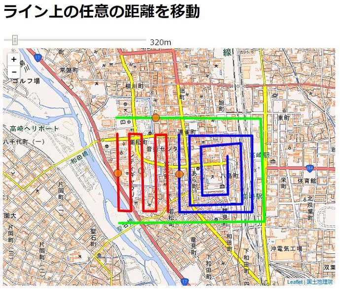
[Turf.js]ラインに沿って任意の距離を移動する
スライダーで選択した距離だけ各ライン上に沿ってマーカーが移動します。
サンプル
|
1 2 3 4 5 6 7 8 9 10 11 12 13 14 15 16 17 18 19 20 21 22 23 24 25 26 27 28 29 30 31 32 33 34 35 36 37 38 39 40 41 42 43 44 45 46 47 48 49 50 51 52 53 54 55 56 57 58 59 60 61 62 63 64 65 66 67 |
fetch('../_dataset/line.geojson') .then(function(response) { return response.json() }).then(function(json) { draw(json) }); function draw(geodata){ var map = L.map('map').setView([36.3221588, 139.00579059999], 15); //地理院地図レイヤー追加 L.tileLayer( 'http://cyberjapandata.gsi.go.jp/xyz/std/{z}/{x}/{y}.png', { attribution: "<a href='http://www.gsi.go.jp/kikakuchousei/kikakuchousei40182.html' target='_blank'>国土地理院</a>" } ).addTo(map); //ラインレイヤー追加 var lineLayer = L.geoJson(geodata, { style: function(feature) { switch (feature.properties.id) { case 1: return {color: "#ff0000",opacity:1}; case 2: return {color: "#0000ff",opacity:1}; case 3: return {color: "#00ff00",opacity:1}; } } }).addTo(map); //マーカーのスタイルを指定する var geojsonMarkerOptions = { radius: 8, fillColor: "#ff7800", color: "#000", weight: 1, opacity: 1, fillOpacity: 0.8 }; //マーカーレイヤーを準備 var markerLayer = L.geoJson(null, { pointToLayer: function (feature, latlng) { return L.circleMarker(latlng, geojsonMarkerOptions); } }).addTo(map); //マーカーをライン上の任意の位置へ追加する var addMarker = function(meter){ markerLayer.clearLayers(); //前回のバッファをクリア var buffered = geodata.features.map(function(feature){ return turf.along(feature, meter/1000, "kilometers"); }); markerLayer.addData(buffered); }; //スライダーの値が変更された際の処理 document.querySelector("#range").addEventListener("change", function(){ var meter = this.value; document.querySelector("#meter").innerText = meter; document.querySelector("#meter").textContent = meter; //firefox用 addMarker(meter); }) //初回だけchangeイベントをJSで発火させる document.querySelector("#range").dispatchEvent(new Event('change')) } |